Radio Mobile accepts several forms of elevation data including DTED, SRTM and GTOPO30. This page on the Radio Mobile website has several sources listed. You may notice that there is no source for DTED listed on the Radio Mobile website. This is a result of the release of higher resolution SRTM data however there are a few holes in the coverage. For that reason I DTED along with SRTM and GTOPO30.
GTOPO30
To download GTOPO30
data visit this website: http://edcdaac.usgs.gov/gtopo30/gtopo30.html
You should see a map of the world at the top of the page (Figure 2.)

Figure 2: GTOPO30 Download Page
Click on the area of the world where you live and you will be taken to a page with instructions for downloading the data. Make a note of the tile name and also read the notice regarding using WinZip to extract the elevation data (this will be important later.) Click on the filename to download a compressed tarball. The files are relatively large, about 15MB, so it may take you a while to download the file. Save this file to a the same location where you saved the Radio Mobile installation files (C:\Temp for instance.) You can now skip to the next step, Installing Elevation Data, or read on.
DTED
At one point the Radio Mobile web site hosted a utility to convert DEM data to DTED for use with Radio Mobile. Since SRTM was made available that tool was removed as well as references to using DTED elevation data with Radio Mobile. You can download a copy of DEMXDTED.EXE from the files section of this website. You will need this tool to convert the DEM data into DTED. DEM data for the United States can be obtained from this site: http://edc.usgs.gov/glis/hyper/guide/1_dgr_demfig/index1m.html (Figure 3.)
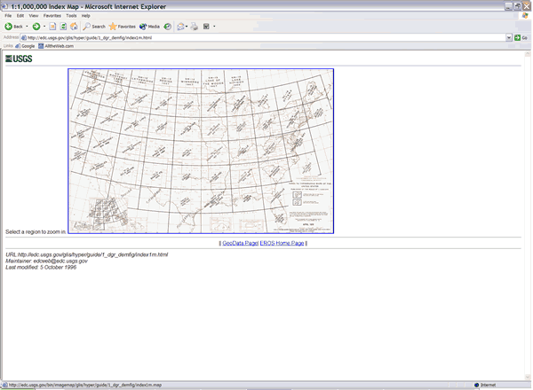
Figure 3: DEM United States Map
Click on the area of the map where you live and drill down (Figures 4 and 5) until you reach a page that lists the DEM files in compressed and uncompressed files. You will want to download the compressed files to save time and bandwidth. The files are compressed using the GZip format.
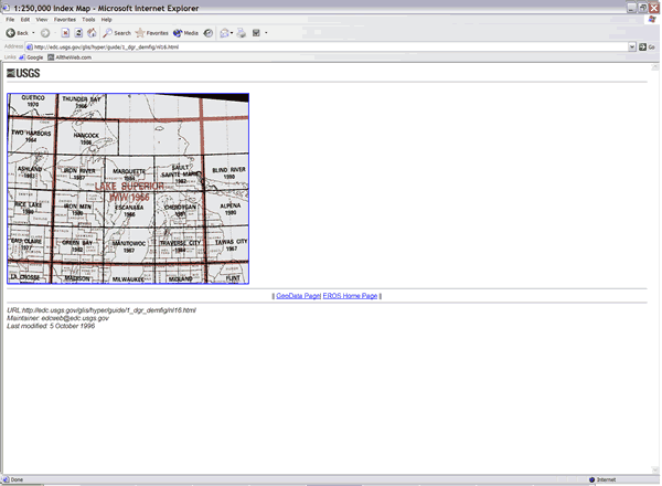
Figure 4: DEM Map Index
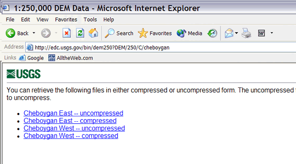
Figure 5: DEM Download
Save the compressed files to your hard drive and uncompress them using a utility such as WinRAR. Now you will need to convert the DEM data into DTED for use with Radio Mobile. First start the DEMXDTED utility (Figure 6.) Point the DEM path dialog to the directory where your uncompressed DEM files are located. Select a location for the DTED data and then click on the "Create DTED" button. In a few seconds you will have a newly created directory called dted. Make a note of its location and move on to Installing Elevation Data or continue reading.
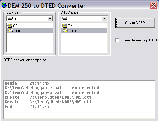
Figure 6: DEM 250 to DTED Converter
SRTM
Obtaining SRTM data is a bit more tricky than GTOPO30 or DTED. The website for downloading the data is not the easiest to navigate and if you are the slightest bit impatient you will get frustrated quickly. Finding the correct data is easier if you know the latitude and longitude for your location. SRTM data can be downloaded from ftp://e0dps01u.ecs.nasa.gov/srtm/United_States_1arcsec/1arcsec/ Use and FTP client such as WS FTP and not a web browser. It is much easier to download multiple files (and you will need to download several.) Each compressed file is about 2MB. I downloaded 16 of the files and extracted them to C:\Temp\SRTM for later use. If you are confused at this point do not worry. In the section "Creating a Map" you can learn how to have Radio Mobile tell you which files you are missing and then download them. For now, move on to the next section, Installing Elevation Data.
Update: It is now even easier to use SRTM data with Radio Mobile. Radio Mobile will automatically download the proper SRTM data when creating maps.