Creating a plot of a point-to-point (PtP) link is just as easy as creating a basic coverage plot but there are a couple more steps involved. First create a new map centered at -84.46554 W and 45.67827 N. With the pixel width and height set to 1000 and the height in KM set to 15 as before. The resulting map should look similar to Figure 25 below.
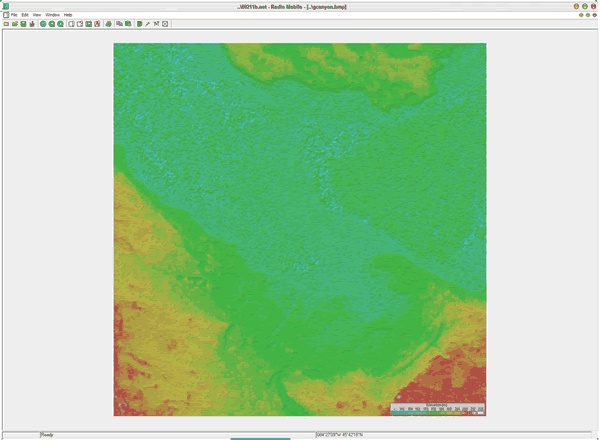
Figure 25: Point-to-Point Link Map
Next click on Edit and select Unit Properties. Turn off the CPE and Access Point units by clearing the check from the box next to "Enabled." This is not necessary it just removes a little clutter from the screen. You should now see two icons labeled Bridge1 and Bridge two overlayed on the map. These are the endpoints of the point-to-point link. To see a profile of the radio link click on View and select the first option, radio link. You should see a window similar to Figure 26.

Figure 26: Radio link
Here you can see a side profile of the radio link as well as the 1st and 2nd Fresnel zones. Under the view menu you can select an option to swap the endpoints of the link to see how the terrain effects the link in both directions. This can produce some interesting results. It can also help you diagnose a troublesome link. Click on edit, select export to and then select RmPath to see a closeup view of the Fresnel zone (Figure 27.) Note that this doesn't take tree coverage or buildings into consideration. This is a view of the link over flat terrain.
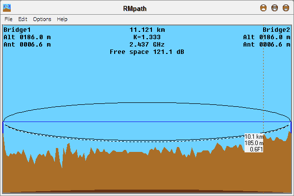
Figure 27: RmPath
This tutorial has been a simple overview to get someone up and running quickly with Radio Mobile. There are many other things this software can accomplish. The best way to learn the software is to take a few GPS readings and experiment with different settings. It is also beneficial to configure the networks, systems and units using equipment that you plan on using. I have found Radio Mobile to be accurate about 80% of the time. I believe the accuracy would be improved if I had antenna patterns for the actual antennas I am using as well as a way to take trees and buildings into consideration. For WISP use this is a very useful tool and can save you hours of time doing site surveys and planning networks. If you require something more powerful I would recommend a commercial software package such as Commstudy.
I hope this tutorial has been useful. I have never written a howto document and I am not the best at training individuals on the use of software that I have been using for a long period of time. If you have suggestions that would improve this document please e-mail them to me at alcamenes@yahoo.com or post suggestions to the Yahoo! Discussion Group for Radio Mobile.